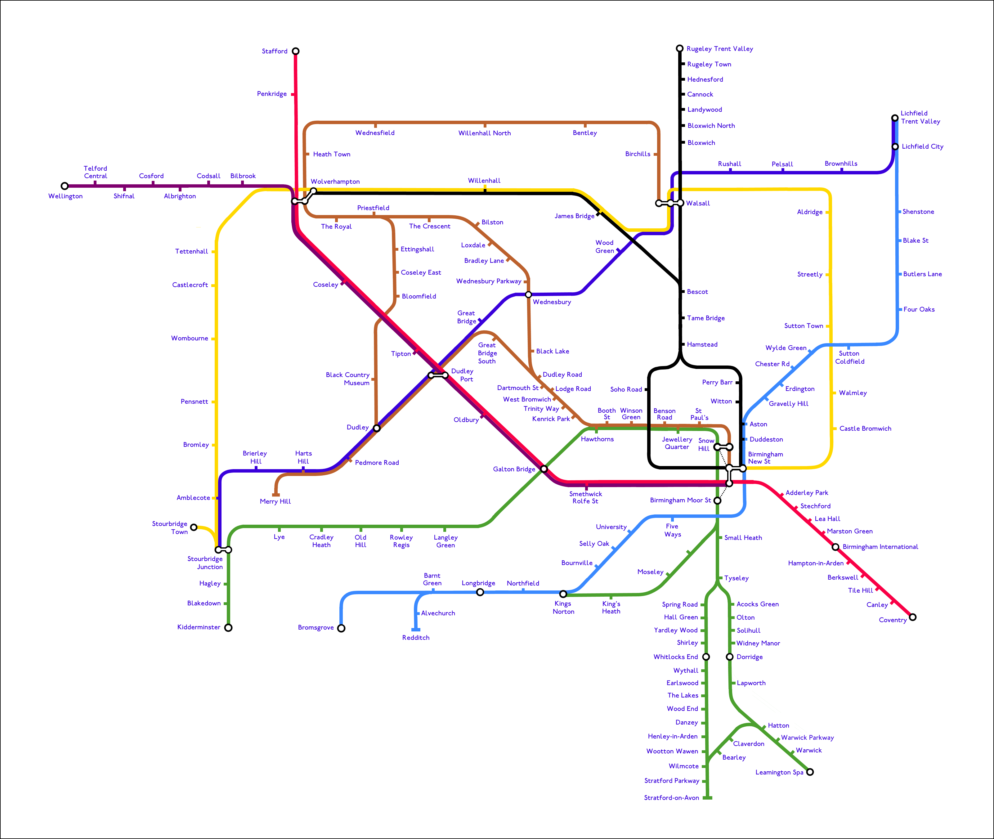
In our dreams. What the railways and/or tramways of the West Midlands conurbation might have looked like if the closed railway alignments of the Black
Country had been brought back into use. Needless to say it's complete fantasy for a number of reasons, notably that some of the alignments
have been built on; and some of these lines don't go directly to central Birmingham, so don't count. Raising the money for any developments
also appears to be nearly impossible, such that in the 38 years since the Cross-City line was established in 1978, providing the southern
section of that line with a usable service, the only significant re-openings achieved have been Walsall to Rugeley and the Midland Metro
line 1. The diversion of Stourbridge trains from New St to Snow Hill has also happened in that timeframe, but that was as much for
operational reasons as passenger benefits. The only truly new piece of railway that the map imagines is the proposed curve at Bordesley
to connect the Camp Hill line to Moor St.
From a graphics perspective the objective
was to mimic the style of Mr Beck's famous diagram of the London Underground. My original idea had been to simply replace the stations on
the LUL central zone diagram, with Paddington becoming Wolverhampton, Kings Cross becoming Walsall, Earls Court becoming Stourbridge Jct,
and Charing Cross/Embankment becoming Snow Hill and New St. In practise there aren't enough lines (open or closed) in the West Midlands to
make this possible, so this effort is a total re-design, albeit trying to mimic the rectilinear shape and colours of the LUL map as closely
as possible.